Tocht Stappen Bellefont-La Rauze - Ste-Marguerite_château de Laroque des Arcs 5,4 - Photo

Ste-Marguerite_château de Laroque des Arcs 5,4

 PariseJL
PariseJL

Gebruiker

© OpenStreetMap contributors
Lengte
Lengte
5,3 km
Max. hoogte
Max. hoogte
255 m
Positief hoogteverschil
192 m
Km-Effort
Km-Effort  
7,9 km
Min. hoogte
Min. hoogte
152 m
Negatief hoogteverschil
196 m
Boucle
Boucle
Ja
Datum van aanmaak :
2019-08-12 08:45:50.071
Laatste wijziging :
2019-08-12 12:09:33.414

(1 Bericht)

Stappen
Stappen
2h11
Moeilijkheid : Gemakkelijk

Scan deze QR-code om de tocht te openen in de SityTrail-applicatie

Gratisgps-wandelapplicatie

Logo SityTrail SityTrail

IGN / Geografische instituten

SityTrail uit de App Store downloaden SityTrail uit Google Play downloaden

Logo SityTrail SityTrail World

De wereld gaat voor u open

SityTrail uit de App Store downloaden SityTrail uit Google Play downloaden SityTrail op Huawei AppGallery downloaden

Over ons

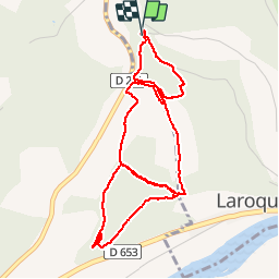
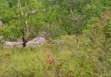
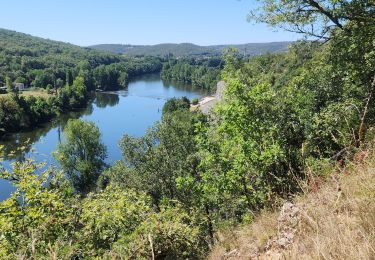
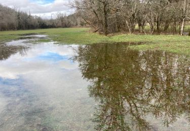
Tocht Stappen van 5,3 km beschikbaar op Occitanië, Lot, Bellefont-La Rauze. Deze tocht wordt voorgesteld door PariseJL.

Hoogteprofiel

Plaatsbepaling

Land:
France
Regio :
Occitanië
Departement/Provincie :
Lot
Gemeente :
Bellefont-La Rauze
Locatie:
Laroque-des-Arcs
Vertrek:(UTM)
377180 ; 4926889 (31T) N.

Opmerkingen

Gelieve in te loggen om een commentaar of een beoordeling achter te laten


certaines parties de chemin sont introuvables !


Wandeltochten in de omgeving

Tocht Stappen Pradines - Cahors les Durands 7km - Photo
Stappen
PariseJL

Stappen

Gemakkelijk
(1)
Pradines, Occitanië, Lot, France
7,1 km | 9,3 km-effort
2h 13min
Ja
Tocht Mountainbike Lamagdelaine - lamagdelaine, vers - Photo
Mountainbike
francislassauce

Mountainbike

Zeer moeilijk
Lamagdelaine, Occitanië, Lot, France
33 km | 41 km-effort
2h 19min
Ja
Tocht Noords wandelen Pradines - 15km chemin des combettes - Photo
Noords wandelen
Dominique Molinier

Noords wandelen

Heel gemakkelijk
(1)
Pradines, Occitanië, Lot, France
14,8 km | 17,9 km-effort
2h 15min
Ja
Tocht Stappen Bellefont-La Rauze - Larroque des arcs constant valroufie  - Photo
Stappen
GUIDE
antignacs

Stappen

Heel gemakkelijk
Bellefont-La Rauze, Occitanië, Lot, France
11,6 km | 15 km-effort
2h 38min
Ja
Tocht Stappen Cahors - Croix magne  - Photo
Stappen
GUIDE
antignacs

Stappen

Heel gemakkelijk
Cahors, Occitanië, Lot, France
5,2 km | 7,2 km-effort
1h 20min
Neen
Tocht Stappen Cahors - Étape Cahors Lascabannes  - Photo
Stappen
Jean-MarieFaux

Stappen

Gemakkelijk
Cahors, Occitanië, Lot, France
23 km | 30 km-effort
18h 50min
Neen
Tocht Stappen Cahors - CahorsMontcuq - Photo
Stappen
patrickdanilo

Stappen

Medium
Cahors, Occitanië, Lot, France
22 km | 29 km-effort
4h 40min
Neen
Tocht Motor Cahors - ballade touristique - Photo
Motor
alain46

Motor

Heel gemakkelijk
Cahors, Occitanië, Lot, France
78 km | 95 km-effort
1h 45min
Neen
Tocht Lopen Cahors - Cahors, le Lot, le causse, la vieille ville - Photo
Lopen
tracegps

Lopen

Medium
Cahors, Occitanië, Lot, France
7,3 km | 10 km-effort
45min
Ja


Sluiten
Mijn abonnementen